Title:
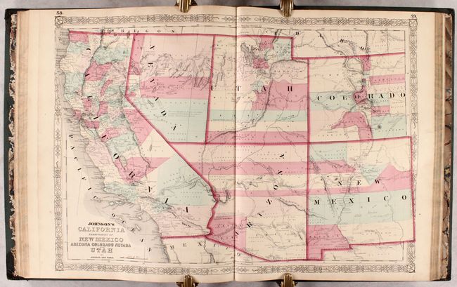
“Johnson's New Ilustrated (Steel Plate) Family Atlas, with Physical Geography, and with Descriptions Geographical, Statistical, and Historical...”
Map Maker:
Johnson & Ward
This complete atlas contains 66 beautifully render... (full text available to subscribers)
| Item Detail |
| |
| |
MapMaker: |
Johnson & Ward
|
|
| |
| |
Subject: |
Atlases |
|
| |
Period/Size: |
1863 / 18.7" x 15.0" (47.5 x 38.1 cm)
|
|
| |
Color: |
Colored
|
|
| |
Condition: |
(B+) The maps are in very good to near fine condition with very light toning and occasional minor soiling or spots of foxing. The map of North America has some light foxing and worm tracks in the margins and left border. The sheet with France and Hollan (condition help) |
|
| |
Source: |
|
|
| |
References: |
|
|
| |
|
|
| Sales Information |
| |
| |
Price: |
|
|
| |
| |
Offered by: |
Old World Auctions |
|
| |
Catalog: |
Auction No. 181 - Antique Maps, Charts, Atlases & Globes (9527) |
|
| |
Lot/Item #: |
742 |
|
| |
| |
Date: |
02/2021
|
|
| |
| |
|
Antique Maps - Valuation and Pricing, Descriptions, Resources |
|
Home |
Information |
Search |
Register |
Contact Us |
Site Map
Americana Exchange, Inc. © 1999 - 2024 Americana Exchange, Inc.. All rights reserved.
OldMaps.com, the OldMaps.com logo and
AMPR are service marks or registered service marks of Americana Exchange, Inc..
|