Title:
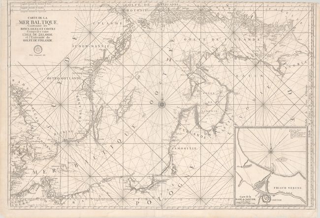
“Carte de la Mer Baltique Contenant les Bancs, Isles et Costes Comprises Entre l'Isle de Zelande et l'Extremite du Golfe de Finlande”
Map Maker:
Depot de la Marine
This superb, large sea chart of the Baltic Sea is ... (full text available to subscribers)
| Item Detail |
| |
| |
MapMaker: |
Depot de la Marine
|
|
| |
| |
Subject: |
Baltic Sea |
|
| |
Period/Size: |
1774 / 24.0" x 35.6" (61.0 x 90.5 cm)
|
|
| |
Color: |
Black & White
|
|
| |
Condition: |
(B) A nice impression on watermarked paper with a long split along the upper centerfold and a few short edge tears that have been repaired with archival materials on verso. Part of the neatline and border has been trimmed away at top, and some small chip (condition help) |
|
| |
Source: |
|
|
| |
References: |
cf. Pastoureau, NEPTUNE FRANCAIS A [2]. |
|
| |
|
|
| Sales Information |
| |
| |
Price: |
|
|
| |
| |
Offered by: |
Old World Auctions |
|
| |
Catalog: |
Auction No. 181 - Antique Maps, Charts, Atlases & Globes (9527) |
|
| |
Lot/Item #: |
445 |
|
| |
| |
Date: |
02/2021
|
|
| |
| |
|
Antique Maps - Valuation and Pricing, Descriptions, Resources |
|
Home |
Information |
Search |
Register |
Contact Us |
Site Map
Americana Exchange, Inc. © 1999 - 2024 Americana Exchange, Inc.. All rights reserved.
OldMaps.com, the OldMaps.com logo and
AMPR are service marks or registered service marks of Americana Exchange, Inc..
|