Title:
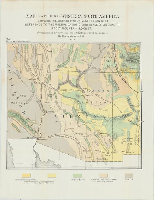
“Map of a Portion of Western North America Showing the Distribution of Vegetation with Reference to the Multiplication and Means of Subduing the Rocky Mountain Locust ... Map I. South Western Section”
Map Maker:
U.S. Government
This interesting map centers on the territory of A... (full text available to subscribers)
| Item Detail |
| |
| |
MapMaker: |
U.S. Government
|
|
| |
| |
Subject: |
Southwestern United States |
|
| |
Period/Size: |
1879 / 14.0" x 15.3" (35.6 x 38.9 cm)
|
|
| |
Color: |
Colored
|
|
| |
Condition: |
(B+) Issued folding, now flattened and professionally backed in Japanese tissue to close some fold separations and a 3.5" edge tear at left. There is faint toning along some of the folds. (condition help) |
|
| |
Source: |
Second Report of the U.S. Entomological Commission for 1878-1879 |
|
| |
References: |
|
|
| |
|
|
| Sales Information |
| |
| |
Price: |
|
|
| |
| |
Offered by: |
Old World Auctions |
|
| |
Catalog: |
Auction No. 181 - Antique Maps, Charts, Atlases & Globes (9527) |
|
| |
Lot/Item #: |
203 |
|
| |
| |
Date: |
02/2021
|
|
| |
| |
|
Antique Maps - Valuation and Pricing, Descriptions, Resources |
|
Home |
Information |
Search |
Register |
Contact Us |
Site Map
Americana Exchange, Inc. © 1999 - 2024 Americana Exchange, Inc.. All rights reserved.
OldMaps.com, the OldMaps.com logo and
AMPR are service marks or registered service marks of Americana Exchange, Inc..
|