Title:
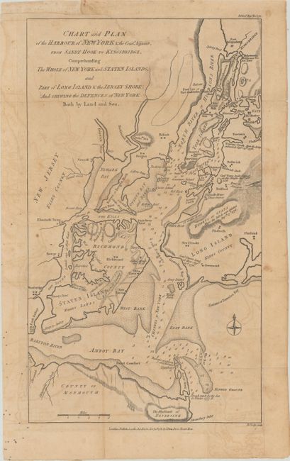
“Chart and Plan of the Harbour of New York & the County Adjacent, from Sandy Hook to Kingsbridge, Comprehending the Whole of New York and Staten Islands...”
Map Maker:
John Lodge
Uncommon Revolutionary War map showing the ... (full text available to subscribers)
| Item Detail |
| |
| |
MapMaker: |
John Lodge
|
|
| |
| |
Subject: |
New York City, New York |
|
| |
Period/Size: |
1781 / 16.5" x 9.5" (42.0 x 24.2 cm)
|
|
| |
Color: |
Black & White
|
|
| |
Condition: |
(B) Issued folding on a watermarked sheet with light toning and offsetting. An edge tear that extends 2.5" into the image at top has been archivally repaired on verso. (condition help) |
|
| |
Source: |
Political Magazine |
|
| |
References: |
Jolly #POL-40; Nebenzahl (Biblio) #104. |
|
| |
|
|
| Sales Information |
| |
| |
Price: |
|
|
| |
| |
Offered by: |
Old World Auctions |
|
| |
Catalog: |
Auction No. 181 - Antique Maps, Charts, Atlases & Globes (9527) |
|
| |
Lot/Item #: |
265 |
|
| |
| |
Date: |
02/2021
|
|
| |
| |
|
Antique Maps - Valuation and Pricing, Descriptions, Resources |
|
Home |
Information |
Search |
Register |
Contact Us |
Site Map
Americana Exchange, Inc. © 1999 - 2024 Americana Exchange, Inc.. All rights reserved.
OldMaps.com, the OldMaps.com logo and
AMPR are service marks or registered service marks of Americana Exchange, Inc..
|