| Item Detail |
| |
| |
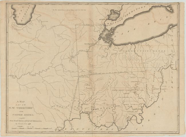
MapMaker: |
Samuel Lewis
|
|
| |
| |
Subject: |
Central United States |
|
| |
Period/Size: |
1796 / 19.2" x 25.3" (48.8 x 64.3 cm)
|
|
| |
Color: |
Black & White
|
|
| |
Condition: |
(B) Issued folding with light offsetting and a few tiny fold separations that have been archivally repaired on verso. Trimmed to the border at top right with several manuscript place names added to the map. (condition help) |
|
| |
Source: |
|
|
| |
References: |
Phillips (Atlases) #3535-47; Wheat & Brun #678. |
|
| |
|
|
| Sales Information |
| |
| |
Price: |
|
|
| |
| |
Offered by: |
Old World Auctions |
|
| |
Catalog: |
Auction No. 181 - Antique Maps, Charts, Atlases & Globes (9527) |
|
| |
Lot/Item #: |
176 |
|
| |
| |
Date: |
02/2021
|
|
| |
| |
|