Title:
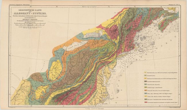
“Geognostische Karte des Alleghany-Systems. Nach den Vorhandenen Arbeiten Sowie Eignen Untersuchungen...”
Map Maker:
Augustus Heinrich Petermann
This detailed geological map of the northeastern U... (full text available to subscribers)
| Item Detail |
| |
| |
MapMaker: |
Augustus Heinrich Petermann
|
|
| |
| |
Subject: |
Eastern United States |
|
| |
Period/Size: |
1871 / 9.7" x 16.3" (24.7 x 41.4 cm)
|
|
| |
Color: |
Colored
|
|
| |
Condition: |
(A) Issued folding and now flattened and backed with tissue. There is faint offsetting from an opposing page of text. (condition help) |
|
| |
Source: |
Geographische Mittheilungen |
|
| |
References: |
|
|
| |
|
|
| Sales Information |
| |
| |
Price: |
|
|
| |
| |
Offered by: |
Old World Auctions |
|
| |
Catalog: |
Auction No. 181 - Antique Maps, Charts, Atlases & Globes (9527) |
|
| |
Lot/Item #: |
152 |
|
| |
| |
Date: |
02/2021
|
|
| |
| |
|
Antique Maps - Valuation and Pricing, Descriptions, Resources |
|
Home |
Information |
Search |
Register |
Contact Us |
Site Map
Americana Exchange, Inc. © 1999 - 2024 Americana Exchange, Inc.. All rights reserved.
OldMaps.com, the OldMaps.com logo and
AMPR are service marks or registered service marks of Americana Exchange, Inc..
|