Title:
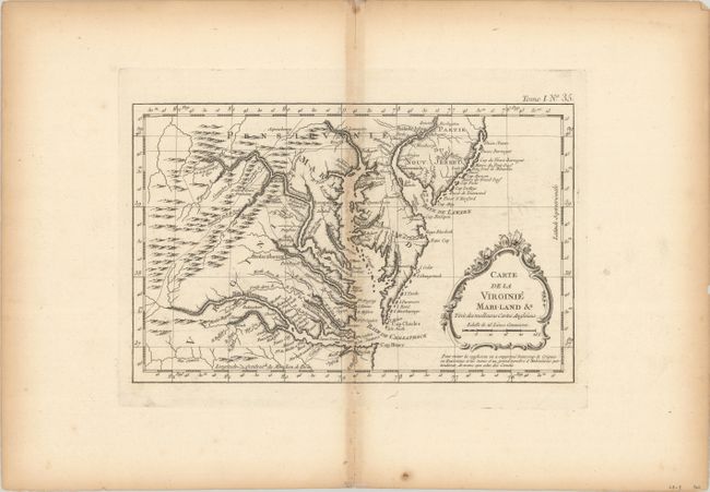
“Carte de la Virginie Mari-Land &a Tiree des Meilleures Cartes Angloises”
Map Maker:
Jacques Nicolas Bellin
Finely engraved colonial map covering most of Virg... (full text available to subscribers)
| Item Detail |
| |
| |
MapMaker: |
Jacques Nicolas Bellin
|
|
| |
| |
Subject: |
Colonial Mid-Atlantic United States |
|
| |
Period/Size: |
1764 / 7.4" x 11.8" (18.8 x 30.0 cm)
|
|
| |
Color: |
Black & White
|
|
| |
Condition: |
(B) A dark impression on a watermarked sheet with a bit of faint offsetting. There is light toning along the centerfold and sheet edges. (condition help) |
|
| |
Source: |
Le Petit Atlas Maritime |
|
| |
References: |
|
|
| |
|
|
| Sales Information |
| |
| |
Price: |
|
|
| |
| |
Offered by: |
Old World Auctions |
|
| |
Catalog: |
Auction No. 181 - Antique Maps, Charts, Atlases & Globes (9527) |
|
| |
Lot/Item #: |
160 |
|
| |
| |
Date: |
02/2021
|
|
| |
| |
|
Antique Maps - Valuation and Pricing, Descriptions, Resources |
|
Home |
Information |
Search |
Register |
Contact Us |
Site Map
Americana Exchange, Inc. © 1999 - 2024 Americana Exchange, Inc.. All rights reserved.
OldMaps.com, the OldMaps.com logo and
AMPR are service marks or registered service marks of Americana Exchange, Inc..
|