| Item Detail |
| |
| |
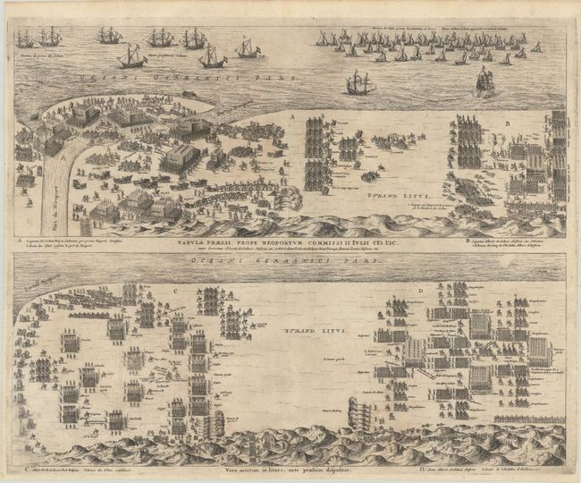
MapMaker: |
Gregorio Leti
|
|
| |
| |
Subject: |
Nieuwpoort, Belgium |
|
| |
Period/Size: |
1690 / 16.0" x 20.1" (40.7 x 51.1 cm)
|
|
| |
Color: |
Black & White
|
|
| |
Condition: |
(B+) Issued folding and now flattened and backed with thin tissue. There are a few short fold separations and one small tear that have been closed on verso with tissue and hinge tape (at top only). Light scattered foxing. (condition help) |
|
| |
Source: |
|
|
| |
References: |
|
|
| |
|
|
| Sales Information |
| |
| |
Price: |
|
|
| |
| |
Offered by: |
Old World Auctions |
|
| |
Catalog: |
Auction No. 181 - Antique Maps, Charts, Atlases & Globes (9527) |
|
| |
Lot/Item #: |
451 |
|
| |
| |
Date: |
02/2021
|
|
| |
| |
|