| Item Detail |
| |
| |
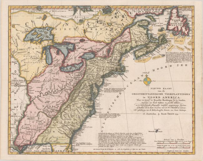
MapMaker: |
Isaac Tirion
|
|
| |
| |
Subject: |
Colonial Eastern United States & Canada |
|
| |
Period/Size: |
1755 / 14.5" x 18.0" (36.9 x 45.8 cm)
|
|
| |
Color: |
Colored
|
|
| |
Condition: |
(A) A crisp impression issued folding, now flattened, with faint offsetting. There is a professionally repaired binding trim at right with an associated repaired tear that just passes the neatline. (condition help) |
|
| |
Source: |
|
|
| |
References: |
McCorkle #755.39 &769.1; Sellers and Van Ee #63. |
|
| |
|
|
| Sales Information |
| |
| |
Price: |
|
|
| |
| |
Offered by: |
Old World Auctions |
|
| |
Catalog: |
Auction No. 181 - Antique Maps, Charts, Atlases & Globes (9527) |
|
| |
Lot/Item #: |
106 |
|
| |
| |
Date: |
02/2021
|
|
| |
| |
|