Title:
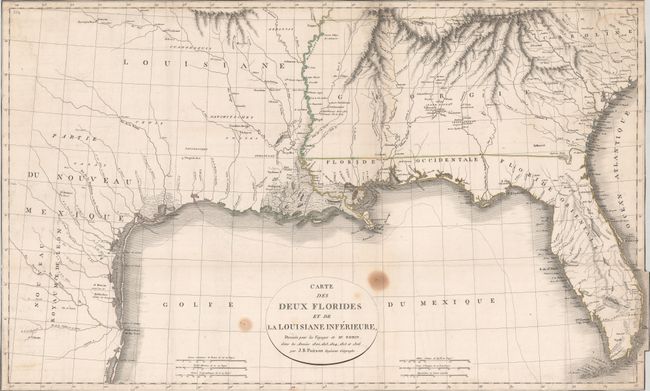
“Carte des Deux Florides et de la Louisiane Inferieure, Dressee pour les Voyages de Mr. Robin, dans les Annees 1802, 1803, 1804, 1805 et 1806”
Map Maker:
Jean Baptiste Poirson
This uncommon map of the southern United States wa... (full text available to subscribers)
| Item Detail |
| |
| |
MapMaker: |
Jean Baptiste Poirson
|
|
| |
| |
Subject: |
Southern United States |
|
| |
Period/Size: |
1806 / 16.1" x 26.6" (40.9 x 67.6 cm)
|
|
| |
Color: |
Colored
|
|
| |
Condition: |
(B) Issued folding on watermarked paper and now flattened and backed with tissue. Trimmed to the border all around with a few worm tracks along the lower border and two stains adjacent to the title cartouche. (condition help) |
|
| |
Source: |
Voyages dans l'interieur de la Louisiane... |
|
| |
References: |
Howes #R-362; Sabin #72039. |
|
| |
|
|
| Sales Information |
| |
| |
Price: |
|
|
| |
| |
Offered by: |
Old World Auctions |
|
| |
Catalog: |
Auction No. 181 - Antique Maps, Charts, Atlases & Globes (9527) |
|
| |
Lot/Item #: |
171 |
|
| |
| |
Date: |
02/2021
|
|
| |
| |
|
Antique Maps - Valuation and Pricing, Descriptions, Resources |
|
Home |
Information |
Search |
Register |
Contact Us |
Site Map
Americana Exchange, Inc. © 1999 - 2024 Americana Exchange, Inc.. All rights reserved.
OldMaps.com, the OldMaps.com logo and
AMPR are service marks or registered service marks of Americana Exchange, Inc..
|