Title:
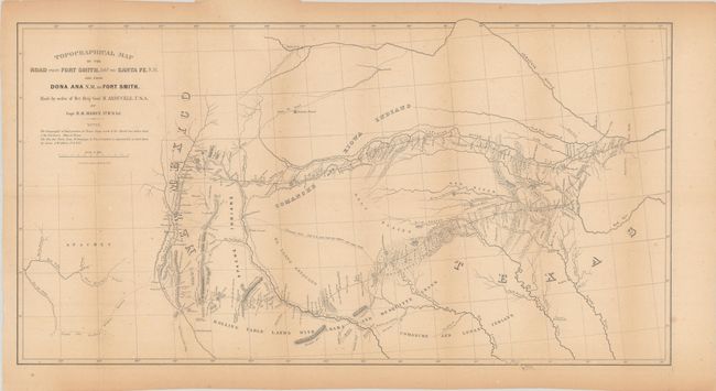
“Topographical Map of the Road from Fort Smith, Arks. to Santa Fe, N.M. and from Dona Ana N.M. to Fort Smith”
Map Maker:
Randolph Barnes Marcy
This important map delineates, for the first time,... (full text available to subscribers)
| Item Detail |
| |
| |
MapMaker: |
Randolph Barnes Marcy
|
|
| |
| |
Subject: |
Southwestern United States |
|
| |
Period/Size: |
1850 / 15.1" x 27.9" (38.4 x 70.9 cm)
|
|
| |
Color: |
Black & White
|
|
| |
Condition: |
(B+) Issued folding with light toning and minor foxing. A couple of short edge tears confined to the bottom blank margin have been closed on verso with archival tape. (condition help) |
|
| |
Source: |
|
|
| |
References: |
Wheat (TMW) #681. |
|
| |
|
|
| Sales Information |
| |
| |
Price: |
|
|
| |
| |
Offered by: |
Old World Auctions |
|
| |
Catalog: |
Auction No. 181 - Antique Maps, Charts, Atlases & Globes (9527) |
|
| |
Lot/Item #: |
195 |
|
| |
| |
Date: |
02/2021
|
|
| |
| |
|
Antique Maps - Valuation and Pricing, Descriptions, Resources |
|
Home |
Information |
Search |
Register |
Contact Us |
Site Map
Americana Exchange, Inc. © 1999 - 2024 Americana Exchange, Inc.. All rights reserved.
OldMaps.com, the OldMaps.com logo and
AMPR are service marks or registered service marks of Americana Exchange, Inc..
|