| Item Detail |
| |
| |
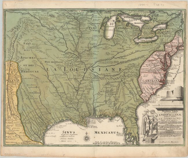
MapMaker: |
Christopher Weigel
|
|
| |
| |
Subject: |
Colonial Eastern United States |
|
| |
Period/Size: |
1734 / 12.4" x 16.3" (31.5 x 41.4 cm)
|
|
| |
Color: |
Colored
|
|
| |
Condition: |
(B) Full contemporary color on a watermarked sheet. There is some light oxidation of the green pigment, and a separation along the upper centerfold that has been repaired on verso with archival materials. Narrow, but adequate, side margins have been rei (condition help) |
|
| |
Source: |
Bequemer Schul-und-Reisen-Atlas... |
|
| |
References: |
Fite & Freeman #46; Tooley (Amer) p. 21. |
|
| |
|
|
| Sales Information |
| |
| |
Price: |
|
|
| |
| |
Offered by: |
Old World Auctions |
|
| |
Catalog: |
Auction No. 181 - Antique Maps, Charts, Atlases & Globes (9527) |
|
| |
Lot/Item #: |
141 |
|
| |
| |
Date: |
02/2021
|
|
| |
| |
|