Title:
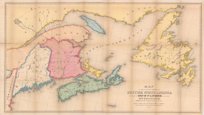
“Map of the Eastern Portion of British North America Including the Gulf of St. Lawrence, and Part of the New England States Compiled from the Latest Surveys and Charts”
Map Maker:
Israel D. Andrews
This sizable map extends from Maine east through t... (full text available to subscribers)
| Item Detail |
| |
| |
MapMaker: |
Israel D. Andrews
|
|
| |
| |
Subject: |
Northeastern United States & Canada |
|
| |
Period/Size: |
1853 / 25.8" x 45.9" (65.6 x 116.6 cm)
|
|
| |
Color: |
Colored
|
|
| |
Condition: |
(B+) Issued folding with light toning and several short splits at the fold junctions. (condition help) |
|
| |
Source: |
H.R. Doc. 136, 32nd Congress, 1st Session |
|
| |
References: |
|
|
| |
|
|
| Sales Information |
| |
| |
Price: |
|
|
| |
| |
Offered by: |
Old World Auctions |
|
| |
Catalog: |
Auction No. 181 - Antique Maps, Charts, Atlases & Globes (9527) |
|
| |
Lot/Item #: |
119 |
|
| |
| |
Date: |
02/2021
|
|
| |
| |
|
Antique Maps - Valuation and Pricing, Descriptions, Resources |
|
Home |
Information |
Search |
Register |
Contact Us |
Site Map
Americana Exchange, Inc. © 1999 - 2024 Americana Exchange, Inc.. All rights reserved.
OldMaps.com, the OldMaps.com logo and
AMPR are service marks or registered service marks of Americana Exchange, Inc..
|