| Item Detail |
| |
| |
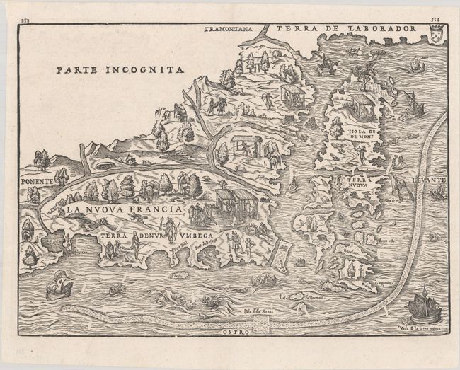
MapMaker: |
Giovanni Battista Ramusio
|
|
| |
| |
Subject: |
Colonial Northeastern United States & Canada |
|
| |
Period/Size: |
1606 / 10.6" x 14.6" (27.0 x 37.1 cm)
|
|
| |
Color: |
Black & White
|
|
| |
Condition: |
(A+) A sharp impression on a bright sheet of watermarked paper with remnants of hinge tape on verso. (condition help) |
|
| |
Source: |
Terzo Volume delle Navigationi et Viaggi |
|
| |
References: |
Augustyn & Cohen, pp. 18-19; Burden #25; Goss #8; Kershaw #15a; McCorkle #556.1; Mickwitz & Miekkavaara #641 Vol. III #4; Sabin #67741; Shirley (BL Atlases) G.RAMU-2a #5; Verner & Stuart-Stubbs #2. |
|
| |
|
|
| Sales Information |
| |
| |
Price: |
|
|
| |
| |
Offered by: |
Old World Auctions |
|
| |
Catalog: |
Auction No. 181 - Antique Maps, Charts, Atlases & Globes (9527) |
|
| |
Lot/Item #: |
113 |
|
| |
| |
Date: |
02/2021
|
|
| |
| |
|