| Item Detail |
| |
| |
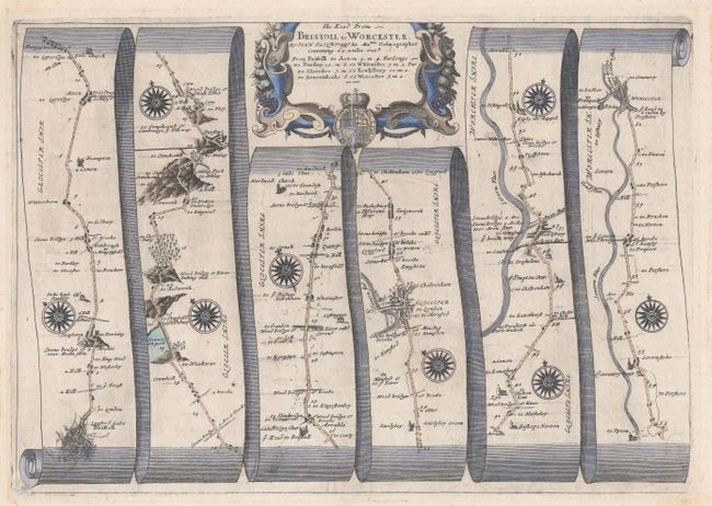
MapMaker: |
John Ogilby
|
|
| |
| |
Subject: |
Western England |
|
| |
Period/Size: |
1675 / 12.3" x 17.5" (31.3 x 44.5 cm)
|
|
| |
Color: |
Colored
|
|
| |
Condition: |
(A) A crisp impression on a bright sheet with a printer's crease adjacent to the centerfold at top and remnants of hinge tape on verso. There are significant stains confined to the blank margins that would be completely obscured if framed and do not impa (condition help) |
|
| |
Source: |
Britannia |
|
| |
References: |
Shirley (BL Atlases) T.OGIL-4a #59. |
|
| |
|
|
| Sales Information |
| |
| |
Price: |
|
|
| |
| |
Offered by: |
Old World Auctions |
|
| |
Catalog: |
Auction No. 181 - Antique Maps, Charts, Atlases & Globes (9527) |
|
| |
Lot/Item #: |
411 |
|
| |
| |
Date: |
02/2021
|
|
| |
| |
|