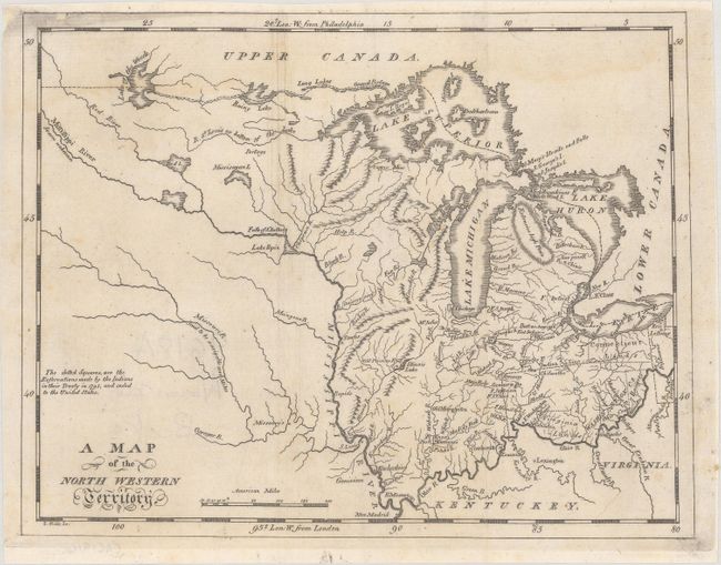
Title:
“A Map of the North Western Territory”
Map Maker:
Jedidiah Morse
This early and fascinating map primarily describes... (full text available to subscribers)
| Item Detail |
| |
| |
MapMaker: |
Jedidiah Morse
|
|
| |
| |
Subject: |
Central United States |
|
| |
Period/Size: |
1796 / 7.3" x 9.4" (18.6 x 23.9 cm)
|
|
| |
Color: |
Black & White
|
|
| |
Condition: |
(B+) There is a faint dampstain along the top border and some light extraneous vertical creasing at center. Professionally remargined at top. (condition help) |
|
| |
Source: |
The American Universal Geography |
|
| |
References: |
McCorkle (18th C. Geography Books) #304-11; Wheat & Brun #679. |
|
| |
|
|
| Sales Information |
| |
| |
Price: |
|
|
| |
| |
Offered by: |
Old World Auctions |
|
| |
Catalog: |
Auction No. 181 - Antique Maps, Charts, Atlases & Globes (9527) |
|
| |
Lot/Item #: |
177 |
|
| |
| |
Date: |
02/2021
|
|
| |
| |
|
Antique Maps - Valuation and Pricing, Descriptions, Resources |
|
Home |
Information |
Search |
Register |
Contact Us |
Site Map
Americana Exchange, Inc. © 1999 - 2024 Americana Exchange, Inc.. All rights reserved.
OldMaps.com, the OldMaps.com logo and
AMPR are service marks or registered service marks of Americana Exchange, Inc..
|