| Item Detail |
| |
| |
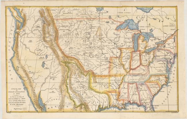
MapMaker: |
George Catlin
|
|
| |
| |
Subject: |
United States |
|
| |
Period/Size: |
1841 / 8.8" x 14.4" (22.4 x 36.6 cm)
|
|
| |
Color: |
Colored
|
|
| |
Condition: |
(B+) On a clean sheet that was issued folding and now flattened. There are professional and nearly invisible repairs to a couple of small fold separations and an associated 4" tear (from the Missouri River to the Pawnees' camps). (condition help) |
|
| |
Source: |
|
|
| |
References: |
Wheat (TMW) #453; Howes #C-241; Wagner-Camp #84:1. |
|
| |
|
|
| Sales Information |
| |
| |
Price: |
|
|
| |
| |
Offered by: |
Old World Auctions |
|
| |
Catalog: |
Auction No. 181 - Antique Maps, Charts, Atlases & Globes (9527) |
|
| |
Lot/Item #: |
127 |
|
| |
| |
Date: |
02/2021
|
|
| |
| |
|