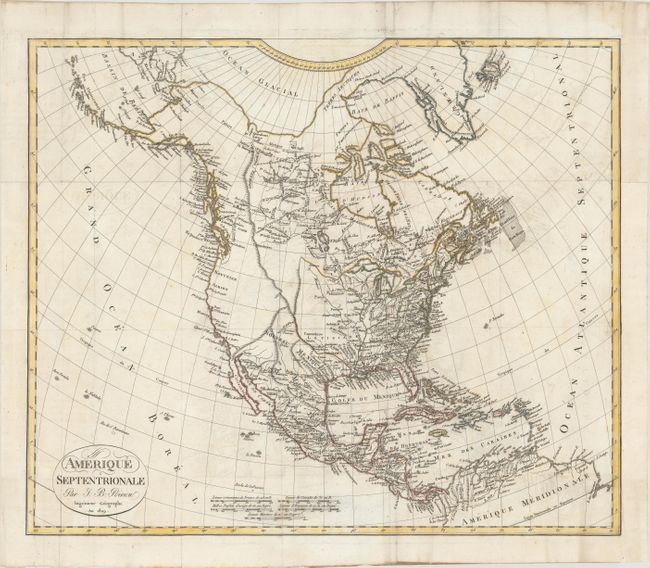
Title:
“Amerique Septentrionale”
Map Maker:
Jean Baptiste Poirson
This attractive map shows the United States bounda... (full text available to subscribers)
| Item Detail |
| |
| |
MapMaker: |
Jean Baptiste Poirson
|
|
| |
| |
Subject: |
North America |
|
| |
Period/Size: |
1809 / 14.4" x 17.1" (36.6 x 43.5 cm)
|
|
| |
Color: |
Colored
|
|
| |
Condition: |
(B+) Issued folding on watermarked paper with light offsetting and a few spots of foxing. Remargined at right with a small portion of border in facsimile. (condition help) |
|
| |
Source: |
|
|
| |
References: |
|
|
| |
|
|
| Sales Information |
| |
| |
Price: |
|
|
| |
| |
Offered by: |
Old World Auctions |
|
| |
Catalog: |
Auction No. 181 - Antique Maps, Charts, Atlases & Globes (9527) |
|
| |
Lot/Item #: |
79 |
|
| |
| |
Date: |
02/2021
|
|
| |
| |
|
Antique Maps - Valuation and Pricing, Descriptions, Resources |
|
Home |
Information |
Search |
Register |
Contact Us |
Site Map
Americana Exchange, Inc. © 1999 - 2024 Americana Exchange, Inc.. All rights reserved.
OldMaps.com, the OldMaps.com logo and
AMPR are service marks or registered service marks of Americana Exchange, Inc..
|