Title:
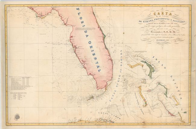
“Carta de los Canales de Bahama, Providencia y Santaren, Costas de la Florida e Isla de Cuba con los Cayos y Bajos, las Islas y Sondas...”
Map Maker:
Direccion de Hidrografia
This Spanish chart of Florida and vicinity extends... (full text available to subscribers)
| Item Detail |
| |
| |
MapMaker: |
Direccion de Hidrografia
|
|
| |
| |
Subject: |
Florida & Bahamas |
|
| |
Period/Size: |
1838 / 21.9" x 33.6" (55.7 x 85.4 cm)
|
|
| |
Color: |
Colored
|
|
| |
Condition: |
(B) Backed with heavy linen to reinforce and repair several short edge tears that extend 1-3" into the images. There are a few chips at right with minor facsimile work that have been archivally repaired including in the ocean adjacent to San Salvador Isl (condition help) |
|
| |
Source: |
|
|
| |
References: |
|
|
| |
|
|
| Sales Information |
| |
| |
Price: |
|
|
| |
| |
Offered by: |
Old World Auctions |
|
| |
Catalog: |
Auction No. 181 - Antique Maps, Charts, Atlases & Globes (9527) |
|
| |
Lot/Item #: |
243 |
|
| |
| |
Date: |
02/2021
|
|
| |
| |
|
Antique Maps - Valuation and Pricing, Descriptions, Resources |
|
Home |
Information |
Search |
Register |
Contact Us |
Site Map
Americana Exchange, Inc. © 1999 - 2024 Americana Exchange, Inc.. All rights reserved.
OldMaps.com, the OldMaps.com logo and
AMPR are service marks or registered service marks of Americana Exchange, Inc..
|