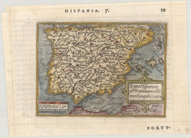
Title:
“Regni Hispaniae Postomnium Editiones Locupleissima”
Map Maker:
Ortelius/Galle
Charming miniature map fully engraved with rivers ... (full text available to subscribers)
| Item Detail |
| |
| |
MapMaker: |
Ortelius/Galle
|
|
| |
| |
Subject: |
Spain & Portugal |
|
| |
Period/Size: |
1579 / 3.1" x 4.3" (7.9 x 11.0 cm)
|
|
| |
Color: |
Colored
|
|
| |
Condition: |
(A) A crisp impression on a bright sheet with a tiny chip and tear along the left edge of the sheet. (condition help) |
|
| |
Source: |
Le Miroir du Monde |
|
| |
References: |
King (2nd Ed.) pp. 60-61; Van der Krogt (Vol. III) #6000:331. |
|
| |
|
|
| Sales Information |
| |
| |
Price: |
|
|
| |
| |
Offered by: |
Old World Auctions |
|
| |
Catalog: |
Auction No. 181 - Antique Maps, Charts, Atlases & Globes (9527) |
|
| |
Lot/Item #: |
472 |
|
| |
| |
Date: |
02/2021
|
|
| |
| |
|
Antique Maps - Valuation and Pricing, Descriptions, Resources |
|
Home |
Information |
Search |
Register |
Contact Us |
Site Map
Americana Exchange, Inc. © 1999 - 2024 Americana Exchange, Inc.. All rights reserved.
OldMaps.com, the OldMaps.com logo and
AMPR are service marks or registered service marks of Americana Exchange, Inc..
|