Title:
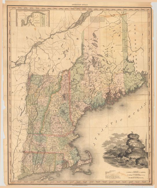
“Map of the States of Maine New Hampshire Vermont Massachusetts Connecticut & Rhode Island”
Map Maker:
Henry Schenck Tanner
This large, attractive map of New England was publ... (full text available to subscribers)
| Item Detail |
| |
| |
MapMaker: |
Henry Schenck Tanner
|
|
| |
| |
Subject: |
New England - United States |
|
| |
Period/Size: |
1820 / 26.6" x 21.4" (67.6 x 54.4 cm)
|
|
| |
Color: |
Colored
|
|
| |
Condition: |
(B) A nice impression on a sheet that fully separated along the centerfold and has been skillfully rejoined with tissue on verso. There are several small repaired edge tears including two along the right border that extend about 1" into the image. Sever (condition help) |
|
| |
Source: |
American Atlas |
|
| |
References: |
Phillips (Atlases) #4462-8. |
|
| |
|
|
| Sales Information |
| |
| |
Price: |
|
|
| |
| |
Offered by: |
Old World Auctions |
|
| |
Catalog: |
Auction No. 181 - Antique Maps, Charts, Atlases & Globes (9527) |
|
| |
Lot/Item #: |
158 |
|
| |
| |
Date: |
02/2021
|
|
| |
| |
|
Antique Maps - Valuation and Pricing, Descriptions, Resources |
|
Home |
Information |
Search |
Register |
Contact Us |
Site Map
Americana Exchange, Inc. © 1999 - 2024 Americana Exchange, Inc.. All rights reserved.
OldMaps.com, the OldMaps.com logo and
AMPR are service marks or registered service marks of Americana Exchange, Inc..
|