| Item Detail |
| |
| |
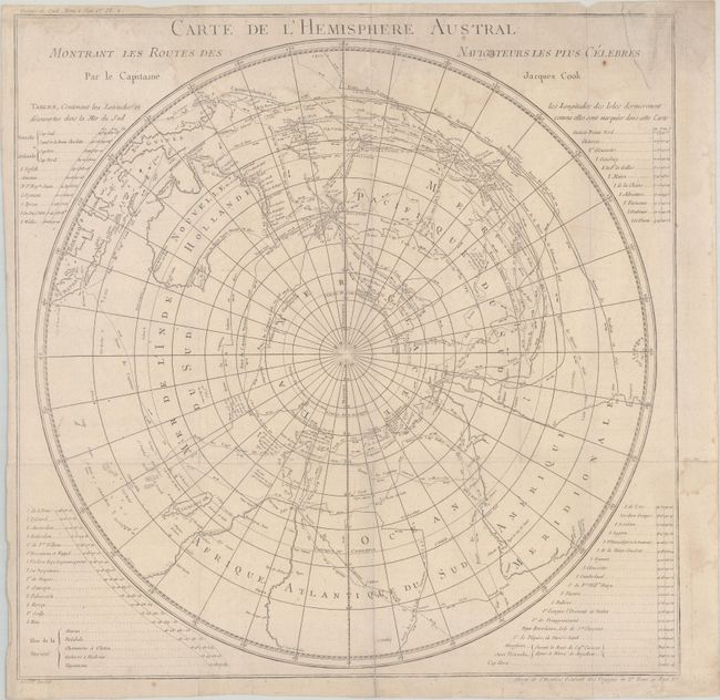
MapMaker: |
Cook/Benard
|
|
| |
| |
Subject: |
South Pole |
|
| |
Period/Size: |
1774 / 21.1" x 21.1" (53.6 x 53.6 cm)
|
|
| |
Color: |
Black & White
|
|
| |
Condition: |
(B+) Issued folding on watermarked paper with light dampstaining that enters map image at top, a printer's crease at top center, and a few small spots. A 3" edge tear at top right and a 2" fold separation at bottom have both been closed on verso with tap (condition help) |
|
| |
Source: |
Abrege de l'Histoire Generale des Voyages |
|
| |
References: |
|
|
| |
|
|
| Sales Information |
| |
| |
Price: |
|
|
| |
| |
Offered by: |
Old World Auctions |
|
| |
Catalog: |
Auction No. 182 - Antique Maps, Charts, Atlases & Globes (9528) |
|
| |
Lot/Item #: |
42 |
|
| |
| |
Date: |
04/2021
|
|
| |
| |
|