Title:
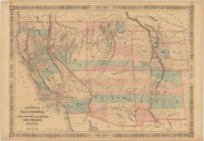
“Johnson's California, with Utah, Nevada, Colorado, New Mexico, and Arizona”
Map Maker:
Johnson & Ward
Johnson’s maps of the American Southwest occupy a ... (full text available to subscribers)
| Item Detail |
| |
| |
MapMaker: |
Johnson & Ward
|
|
| |
| |
Subject: |
Southwestern United States |
|
| |
Period/Size: |
1864 / 16.9" x 23.6" (43.0 x 60.0 cm)
|
|
| |
Color: |
Colored
|
|
| |
Condition: |
(B+) Contemporary color on a lightly toned sheet with minor foxing and a number of centerfold separations that have been repaired on verso with archival materials.
(condition help) |
|
| |
Source: |
New Illustrated Family Atlas |
|
| |
References: |
|
|
| |
|
|
| Sales Information |
| |
| |
Price: |
|
|
| |
| |
Offered by: |
Old World Auctions |
|
| |
Catalog: |
Auction No. 182 - Antique Maps, Charts, Atlases & Globes (9528) |
|
| |
Lot/Item #: |
217 |
|
| |
| |
Date: |
04/2021
|
|
| |
| |
|
Antique Maps - Valuation and Pricing, Descriptions, Resources |
|
Home |
Information |
Search |
Register |
Contact Us |
Site Map
Americana Exchange, Inc. © 1999 - 2024 Americana Exchange, Inc.. All rights reserved.
OldMaps.com, the OldMaps.com logo and
AMPR are service marks or registered service marks of Americana Exchange, Inc..
|