| Item Detail |
| |
| |
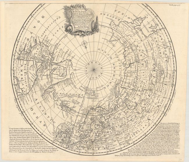
MapMaker: |
Emanuel Bowen
|
|
| |
| |
Subject: |
North Pole |
|
| |
Period/Size: |
1748 / 15.3" x 16.6" (38.9 x 42.2 cm)
|
|
| |
Color: |
Black & White
|
|
| |
Condition: |
(A) A nice impression issued folding, now flat, with a fleur-de-lis watermark. There is some minor scattered foxing and tiny edge tears along the top sheet edge that have been closed on verso with archival tape. (condition help) |
|
| |
Source: |
John Harris' Navigantium Atque Itinerantium Bibliotheca... |
|
| |
References: |
Shirley (BL Atlases) G.HARR-1a #21; Kershaw #418. |
|
| |
|
|
| Sales Information |
| |
| |
Price: |
|
|
| |
| |
Offered by: |
Old World Auctions |
|
| |
Catalog: |
Auction No. 182 - Antique Maps, Charts, Atlases & Globes (9528) |
|
| |
Lot/Item #: |
38 |
|
| |
| |
Date: |
04/2021
|
|
| |
| |
|