Title:
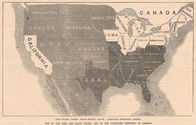
“Map of the Free and Slave States, and of the Unsettled Territory of America”
This map was included in the December 13, 1856 iss... (full text available to subscribers)
| Item Detail |
| |
| |
MapMaker: |
(none given)
|
|
| |
| |
Subject: |
United States |
|
| |
Period/Size: |
1856 / 4.8" x 8.0" (12.2 x 20.4 cm)
|
|
| |
Color: |
Black & White
|
|
| |
Condition: |
(A) On a bright sheet with one small spot in Washington State and a tiny tear along the right edge of the sheet. (condition help) |
|
| |
Source: |
Illustrated London News |
|
| |
References: |
|
|
| |
|
|
| Sales Information |
| |
| |
Price: |
|
|
| |
| |
Offered by: |
Old World Auctions |
|
| |
Catalog: |
Auction No. 182 - Antique Maps, Charts, Atlases & Globes (9528) |
|
| |
Lot/Item #: |
139 |
|
| |
| |
Date: |
04/2021
|
|
| |
| |
|
Antique Maps - Valuation and Pricing, Descriptions, Resources |
|
Home |
Information |
Search |
Register |
Contact Us |
Site Map
Americana Exchange, Inc. © 1999 - 2024 Americana Exchange, Inc.. All rights reserved.
OldMaps.com, the OldMaps.com logo and
AMPR are service marks or registered service marks of Americana Exchange, Inc..
|