| Item Detail |
| |
| |
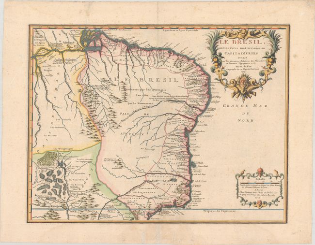
MapMaker: |
Nicholas de Fer
|
|
| |
| |
Subject: |
Brazil |
|
| |
Period/Size: |
1719 / 16.4" x 21.4" (41.7 x 54.4 cm)
|
|
| |
Color: |
Colored
|
|
| |
Condition: |
(B+) A sharp impression on a sturdy sheet with a rosary beads watermark. There is light, scattered foxing, a few archivally repaired tears in blank margins, and faint damp stains at top and bottom. (condition help) |
|
| |
Source: |
Atlas ou Recueil de Cartes Geographiques... |
|
| |
References: |
Pastoureau, FER II C [98]. |
|
| |
|
|
| Sales Information |
| |
| |
Price: |
|
|
| |
| |
Offered by: |
Old World Auctions |
|
| |
Catalog: |
Auction No. 182 - Antique Maps, Charts, Atlases & Globes (9528) |
|
| |
Lot/Item #: |
422 |
|
| |
| |
Date: |
04/2021
|
|
| |
| |
|