Title:
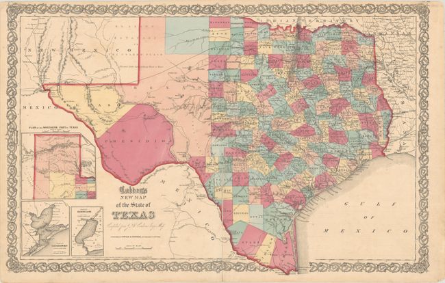
“Colton's New Map of the State of Texas Compiled from De Cordova's Large Map”
Map Maker:
Johnson & Browning
This double-page map shows extensive detail throug... (full text available to subscribers)
| Item Detail |
| |
| |
MapMaker: |
Johnson & Browning
|
|
| |
| |
Subject: |
Texas |
|
| |
Period/Size: |
1855 / 16.6" x 25.9" (42.2 x 65.8 cm)
|
|
| |
Color: |
Colored
|
|
| |
Condition: |
(B) Full contemporary color with a 7" centerfold separation at bottom that has been closed on verso with paper tape. There is light scattered foxing and a couple of short edge tears confined to the side margins that have been closed on verso with archiva (condition help) |
|
| |
Source: |
Illustrated Family Atlas |
|
| |
References: |
|
|
| |
|
|
| Sales Information |
| |
| |
Price: |
|
|
| |
| |
Offered by: |
Old World Auctions |
|
| |
Catalog: |
Auction No. 182 - Antique Maps, Charts, Atlases & Globes (9528) |
|
| |
Lot/Item #: |
322 |
|
| |
| |
Date: |
04/2021
|
|
| |
| |
|
Antique Maps - Valuation and Pricing, Descriptions, Resources |
|
Home |
Information |
Search |
Register |
Contact Us |
Site Map
Americana Exchange, Inc. © 1999 - 2024 Americana Exchange, Inc.. All rights reserved.
OldMaps.com, the OldMaps.com logo and
AMPR are service marks or registered service marks of Americana Exchange, Inc..
|