Title:
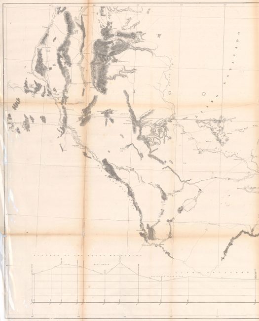
“Map and Profile No. 1. From the Red River to the Rio Grande; from Explorations and Surveys Made Under the Direction of the Hon. Jefferson Davis, Secretary of War”
Map Maker:
John Pope
This map extends from San Antonio and Dallas west ... (full text available to subscribers)
| Item Detail |
| |
| |
MapMaker: |
John Pope
|
|
| |
| |
Subject: |
Texas & New Mexico |
|
| |
Period/Size: |
1854-56 / 27.4" x 56.8" (69.6 x 144.3 cm)
|
|
| |
Color: |
Black & White
|
|
| |
Condition: |
(B) Issued folding and now flat with light toning along the fold lines. There are several short fold separations (a few of which were closed with old tape) with minor loss at the lower left and right fold junctions. There is a bit of glare in the image (condition help) |
|
| |
Source: |
U.S. Pacific Railroad Surveys |
|
| |
References: |
Wheat (TMW) #898. |
|
| |
|
|
| Sales Information |
| |
| |
Price: |
|
|
| |
| |
Offered by: |
Old World Auctions |
|
| |
Catalog: |
Auction No. 182 - Antique Maps, Charts, Atlases & Globes (9528) |
|
| |
Lot/Item #: |
320 |
|
| |
| |
Date: |
04/2021
|
|
| |
| |
|
Antique Maps - Valuation and Pricing, Descriptions, Resources |
|
Home |
Information |
Search |
Register |
Contact Us |
Site Map
Americana Exchange, Inc. © 1999 - 2024 Americana Exchange, Inc.. All rights reserved.
OldMaps.com, the OldMaps.com logo and
AMPR are service marks or registered service marks of Americana Exchange, Inc..
|