| Item Detail |
| |
| |
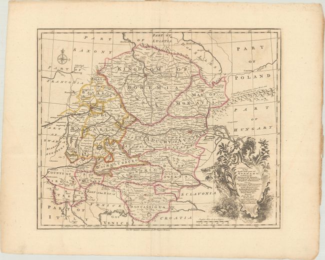
MapMaker: |
Emanuel Bowen
|
|
| |
| |
Subject: |
Central Europe, Germany |
|
| |
Period/Size: |
1751 / 13.6" x 16.6" (34.6 x 42.2 cm)
|
|
| |
Color: |
Colored
|
|
| |
Condition: |
(A) A nice impression on a sheet with a fleur-de-lis watermark, very light offsetting, and a printer's crease at bottom. (condition help) |
|
| |
Source: |
Tindal's Continuation of Rapin's History of England |
|
| |
References: |
Shirley (BL Atlases) G.RAP-2a #11. |
|
| |
|
|
| Sales Information |
| |
| |
Price: |
|
|
| |
| |
Offered by: |
Old World Auctions |
|
| |
Catalog: |
Auction No. 182 - Antique Maps, Charts, Atlases & Globes (9528) |
|
| |
Lot/Item #: |
522 |
|
| |
| |
Date: |
04/2021
|
|
| |
| |
|