Title:
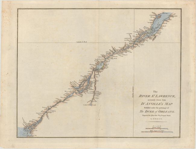
“The River St. Lawrence, Accurately Drawn from D'Anville's Map Publish'd Under the Patronage of the Duke of Orleans”
Map Maker:
John E. Harrison
This detailed map delineates the course of the sea... (full text available to subscribers)
| Item Detail |
| |
| |
MapMaker: |
John E. Harrison
|
|
| |
| |
Subject: |
St. Lawrence River, Canada |
|
| |
Period/Size: |
1784 / 13.1" x 16.5" (33.3 x 42.0 cm)
|
|
| |
Color: |
Colored
|
|
| |
Condition: |
(B+) There is light scattered foxing. (condition help) |
|
| |
Source: |
Atlas to Accompany Rapin's History of England |
|
| |
References: |
Kershaw #681; Phillips (A) #5206-20; Sellers & Van Ee #251. |
|
| |
|
|
| Sales Information |
| |
| |
Price: |
|
|
| |
| |
Offered by: |
Old World Auctions |
|
| |
Catalog: |
Auction No. 182 - Antique Maps, Charts, Atlases & Globes (9528) |
|
| |
Lot/Item #: |
114 |
|
| |
| |
Date: |
04/2021
|
|
| |
| |
|
Antique Maps - Valuation and Pricing, Descriptions, Resources |
|
Home |
Information |
Search |
Register |
Contact Us |
Site Map
Americana Exchange, Inc. © 1999 - 2024 Americana Exchange, Inc.. All rights reserved.
OldMaps.com, the OldMaps.com logo and
AMPR are service marks or registered service marks of Americana Exchange, Inc..
|