Title:
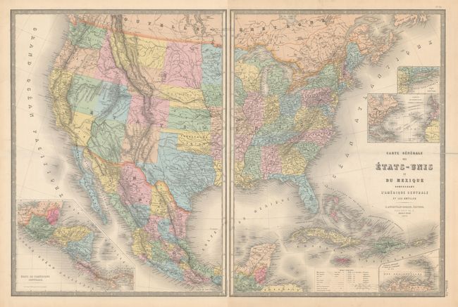
“Carte Generale des Etats-Unis et du Mexique Comprenant l'Amerique Centrale et les Antilles”
Map Maker:
E. Andriveau-Goujon
This attractive French map of covers the United St... (full text available to subscribers)
| Item Detail |
| |
| |
MapMaker: |
E. Andriveau-Goujon
|
|
| |
| |
Subject: |
United States & Mexico |
|
| |
Period/Size: |
1870 / 24.3" x 18.5" (61.8 x 47.0 cm)
|
|
| |
Color: |
Colored
|
|
| |
Condition: |
(B+) There are centerfold separations at left and right on both sheets that have been closed on verso with archival materials. There is minor scattered foxing and light toning in the blank margins. The first image is a composite image - the map is on tw (condition help) |
|
| |
Source: |
Atlas Universel |
|
| |
References: |
|
|
| |
|
|
| Sales Information |
| |
| |
Price: |
|
|
| |
| |
Offered by: |
Old World Auctions |
|
| |
Catalog: |
Auction No. 182 - Antique Maps, Charts, Atlases & Globes (9528) |
|
| |
Lot/Item #: |
349 |
|
| |
| |
Date: |
04/2021
|
|
| |
| |
|
Antique Maps - Valuation and Pricing, Descriptions, Resources |
|
Home |
Information |
Search |
Register |
Contact Us |
Site Map
Americana Exchange, Inc. © 1999 - 2024 Americana Exchange, Inc.. All rights reserved.
OldMaps.com, the OldMaps.com logo and
AMPR are service marks or registered service marks of Americana Exchange, Inc..
|