| Item Detail |
| |
| |
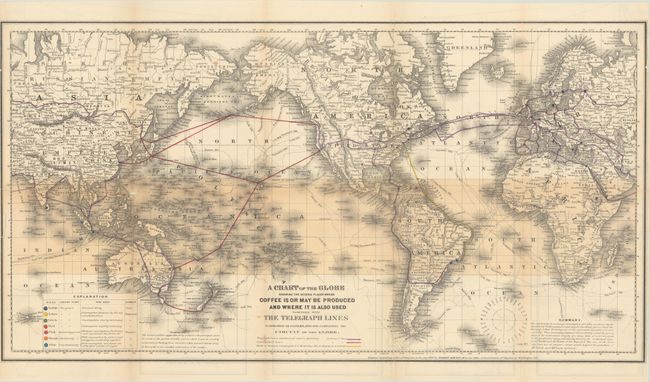
MapMaker: |
Robert Hewitt
|
|
| |
| |
Subject: |
World, Coffee |
|
| |
Period/Size: |
1872 / 13.6" x 25.6" (34.6 x 65.1 cm)
|
|
| |
Color: |
Colored
|
|
| |
Condition: |
(B) Issued folding with a number of short fold separations closed on verso with archival tape and some minor loss at the left fold junction. An adjacent 3.5" tear has also been archivally repaired on verso. Trimmed to the border at left with a narrow ri (condition help) |
|
| |
Source: |
|
|
| |
References: |
|
|
| |
|
|
| Sales Information |
| |
| |
Price: |
|
|
| |
| |
Offered by: |
Old World Auctions |
|
| |
Catalog: |
Auction No. 182 - Antique Maps, Charts, Atlases & Globes (9528) |
|
| |
Lot/Item #: |
20 |
|
| |
| |
Date: |
04/2021
|
|
| |
| |
|