Title:
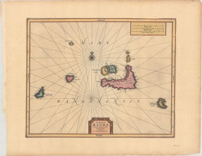
“Les Iles de Banda, Suivant les Meilleures Cartes Levees sur les Lieux”
Map Maker:
Pieter van der Aa
This is a very uncommon map of the Banda Islands, ... (full text available to subscribers)
| Item Detail |
| |
| |
MapMaker: |
Pieter van der Aa
|
|
| |
| |
Subject: |
Banda Islands, Indonesia |
|
| |
Period/Size: |
1729 / 10.8" x 13.4" (27.5 x 34.1 cm)
|
|
| |
Color: |
Colored
|
|
| |
Condition: |
(A) A sharp impression on a slightly toned sheet with a fleur-de-lis watermark. There are some minor spots and printer's ink residue in the map image and a small dampstain in the bottom blank margin. (condition help) |
|
| |
Source: |
|
|
| |
References: |
|
|
| |
|
|
| Sales Information |
| |
| |
Price: |
|
|
| |
| |
Offered by: |
Old World Auctions |
|
| |
Catalog: |
Auction No. 182 - Antique Maps, Charts, Atlases & Globes (9528) |
|
| |
Lot/Item #: |
694 |
|
| |
| |
Date: |
04/2021
|
|
| |
| |
|
Antique Maps - Valuation and Pricing, Descriptions, Resources |
|
Home |
Information |
Search |
Register |
Contact Us |
Site Map
Americana Exchange, Inc. © 1999 - 2024 Americana Exchange, Inc.. All rights reserved.
OldMaps.com, the OldMaps.com logo and
AMPR are service marks or registered service marks of Americana Exchange, Inc..
|