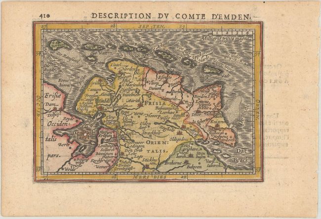
Title:
“Description du Comte d'Emden”
Map Maker:
Hondius/Bertius
Centered on Aurich, map extends to include Dollard... (full text available to subscribers)
| Item Detail |
| |
| |
MapMaker: |
Hondius/Bertius
|
|
| |
| |
Subject: |
Northwestern Germany |
|
| |
Period/Size: |
1618 / 3.7" x 5.3" (9.4 x 13.5 cm)
|
|
| |
Color: |
Colored
|
|
| |
Condition: |
(B+) A nice impression with a hint of toning and one small rust spot at the mouth of the Ems river that has caused a small hole. (condition help) |
|
| |
Source: |
La Geographie Racourcie de Pierre Bertius |
|
| |
References: |
Van der Krogt (Vol. III) #2310:342. |
|
| |
|
|
| Sales Information |
| |
| |
Price: |
|
|
| |
| |
Offered by: |
Old World Auctions |
|
| |
Catalog: |
Auction No. 182 - Antique Maps, Charts, Atlases & Globes (9528) |
|
| |
Lot/Item #: |
528 |
|
| |
| |
Date: |
04/2021
|
|
| |
| |
|
Antique Maps - Valuation and Pricing, Descriptions, Resources |
|
Home |
Information |
Search |
Register |
Contact Us |
Site Map
Americana Exchange, Inc. © 1999 - 2024 Americana Exchange, Inc.. All rights reserved.
OldMaps.com, the OldMaps.com logo and
AMPR are service marks or registered service marks of Americana Exchange, Inc..
|