| Item Detail |
| |
| |
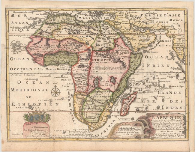
MapMaker: |
Nicholas de Fer
|
|
| |
| |
Subject: |
Africa |
|
| |
Period/Size: |
1717 / 9.1" x 12.4" (23.2 x 31.5 cm)
|
|
| |
Color: |
Colored
|
|
| |
Condition: |
(B+) Issued folding, now flattened with light soiling, some foxing at bottom left, and an archivally repaired binding tear that just enters the map border at left. Remargined at right, top, and top left to accommodate framing. (condition help) |
|
| |
Source: |
L'Atlas Curieux ou le Monde... |
|
| |
References: |
Betz #170.3; Norwich #64 (larger version); Pastoureau, FER ID. |
|
| |
|
|
| Sales Information |
| |
| |
Price: |
|
|
| |
| |
Offered by: |
Old World Auctions |
|
| |
Catalog: |
Auction No. 182 - Antique Maps, Charts, Atlases & Globes (9528) |
|
| |
Lot/Item #: |
713 |
|
| |
| |
Date: |
04/2021
|
|
| |
| |
|