Title:
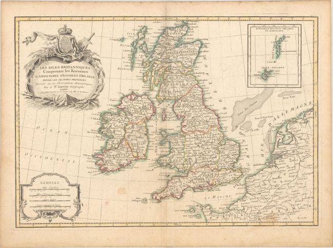
“Les Isles Britanniques Comprenant les Royaumes d'Angleterre d'Ecosse et d'Irlande Divises en Grandes Provinces...”
Map Maker:
Janvier/Lattre
Nicely engraved chart of Britain with an inset of ... (full text available to subscribers)
| Item Detail |
| |
| |
MapMaker: |
Janvier/Lattre
|
|
| |
| |
Subject: |
Britain |
|
| |
Period/Size: |
1771 / 12.1" x 17.5" (30.8 x 44.5 cm)
|
|
| |
Color: |
Colored
|
|
| |
Condition: |
(B) Contemporary outline color on sheet with the watermark of a Maltese cross encircled in rosary beads. There is light toning and soiling, and a few small stains in the image. (condition help) |
|
| |
Source: |
Atlas Moderne |
|
| |
References: |
|
|
| |
|
|
| Sales Information |
| |
| |
Price: |
|
|
| |
| |
Offered by: |
Old World Auctions |
|
| |
Catalog: |
Auction No. 182 - Antique Maps, Charts, Atlases & Globes (9528) |
|
| |
Lot/Item #: |
460 |
|
| |
| |
Date: |
04/2021
|
|
| |
| |
|
Antique Maps - Valuation and Pricing, Descriptions, Resources |
|
Home |
Information |
Search |
Register |
Contact Us |
Site Map
Americana Exchange, Inc. © 1999 - 2024 Americana Exchange, Inc.. All rights reserved.
OldMaps.com, the OldMaps.com logo and
AMPR are service marks or registered service marks of Americana Exchange, Inc..
|