| Item Detail |
| |
| |
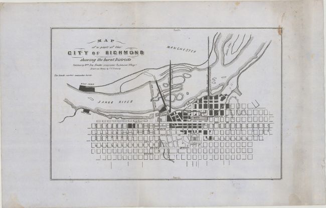
MapMaker: |
Charles L. Ludwig
|
|
| |
| |
Subject: |
Richmond, Virginia |
|
| |
Period/Size: |
1865 / 8.2" x 12.5" (20.9 x 31.8 cm)
|
|
| |
Color: |
Black & White
|
|
| |
Condition: |
(B+) Printed on sturdy, grayish paper with a large Strasburg Lily watermark and light soiling, mostly confined to the right blank margin. There are two vertical creases and some minor extraneous creasing. "North" and "South" have been added in manuscrip (condition help) |
|
| |
Source: |
|
|
| |
References: |
Stephenson (Civil War) #641. |
|
| |
|
|
| Sales Information |
| |
| |
Price: |
|
|
| |
| |
Offered by: |
Old World Auctions |
|
| |
Catalog: |
Auction No. 182 - Antique Maps, Charts, Atlases & Globes (9528) |
|
| |
Lot/Item #: |
340 |
|
| |
| |
Date: |
04/2021
|
|
| |
| |
|