| Item Detail |
| |
| |
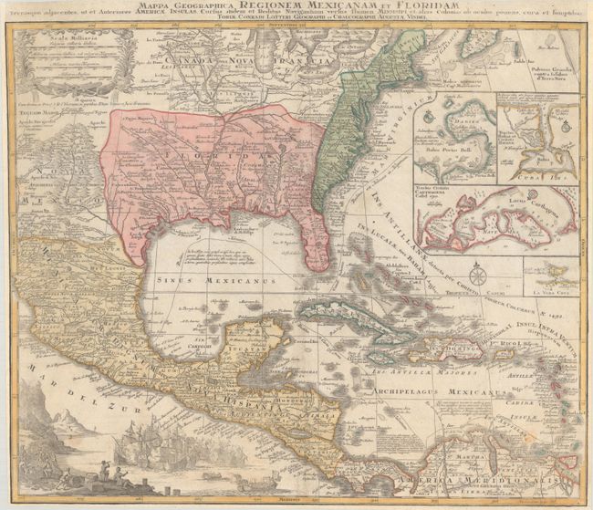
MapMaker: |
Tobias Conrad Lotter
|
|
| |
| |
Subject: |
Colonial Eastern North America & West Indies |
|
| |
Period/Size: |
1760 / 18.8" x 22.3" (47.8 x 56.7 cm)
|
|
| |
Color: |
Colored
|
|
| |
Condition: |
(B) On watermarked paper with light soiling, two small worm holes, and a few wormtracks along the centerfold that have been infilled with archival materials on verso. The map has been professionally remargined at left, right, and bottom, with the neatlin (condition help) |
|
| |
Source: |
|
|
| |
References: |
Martin & Martin, p. 93, plt. 18. |
|
| |
|
|
| Sales Information |
| |
| |
Price: |
|
|
| |
| |
Offered by: |
Old World Auctions |
|
| |
Catalog: |
Auction No. 182 - Antique Maps, Charts, Atlases & Globes (9528) |
|
| |
Lot/Item #: |
109 |
|
| |
| |
Date: |
04/2021
|
|
| |
| |
|