| Item Detail |
| |
| |
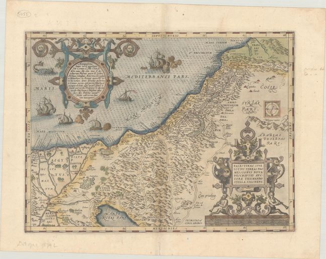
MapMaker: |
Abraham Ortelius
|
|
| |
| |
Subject: |
Holy Land |
|
| |
Period/Size: |
1579 / 13.6" x 18.3" (34.6 x 46.5 cm)
|
|
| |
Color: |
Colored
|
|
| |
Condition: |
(B+) A dark impression on paper with the crossed arrows watermark commonly found on Ortelius maps, light printer's ink residue, minor soiling, and archival repairs to some separations along the centerfold. (condition help) |
|
| |
Source: |
Theatrum Orbis Terrarum |
|
| |
References: |
Nebenzahl (Holy Land) pp. 84-86; Laor #539; Tooley (TMC-3) p. 28; Van den Broecke #171. |
|
| |
|
|
| Sales Information |
| |
| |
Price: |
|
|
| |
| |
Offered by: |
Old World Auctions |
|
| |
Catalog: |
Auction No. 183 - Antique Maps, Charts, Atlases & Globes (9529) |
|
| |
Lot/Item #: |
455 |
|
| |
| |
Date: |
06/2021
|
|
| |
| |
|