| Item Detail |
| |
| |
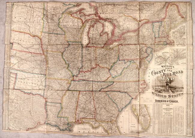
MapMaker: |
Gaylord Watson
|
|
| |
| |
Subject: |
Eastern United States, Railroads |
|
| |
Period/Size: |
1871 / 36.5" x 52.0" (92.8 x 132.1 cm)
|
|
| |
Color: |
Colored
|
|
| |
Condition: |
(B) Issued folding and trimmed to the neatline at left, right and top with some light dampstaining and old tape stains along the sheet edges. There are a number of small fold separations mostly at the junctions with minute loss. Several small tears and (condition help) |
|
| |
Source: |
|
|
| |
References: |
Phillips (Maps) p. 202; cf. Rumsey #2540. |
|
| |
|
|
| Sales Information |
| |
| |
Price: |
|
|
| |
| |
Offered by: |
Old World Auctions |
|
| |
Catalog: |
Auction No. 183 - Antique Maps, Charts, Atlases & Globes (9529) |
|
| |
Lot/Item #: |
129 |
|
| |
| |
Date: |
06/2021
|
|
| |
| |
|