Title:
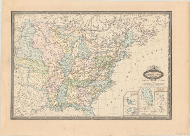
“Etats-Unis de l'Amerique du Nord. Limites en 1835”
Map Maker:
Francis Garnier
This map depicts the state and territorial boundar... (full text available to subscribers)
| Item Detail |
| |
| |
MapMaker: |
Francis Garnier
|
|
| |
| |
Subject: |
Eastern United States |
|
| |
Period/Size: |
1860 / 13.2" x 19.6" (33.6 x 49.8 cm)
|
|
| |
Color: |
Colored
|
|
| |
Condition: |
(A) A crisp impression on a sturdy sheet with a light dampstain and minor foxing all confined to the blank margins. (condition help) |
|
| |
Source: |
Atlas Spheroidal & Universel de Geographie |
|
| |
References: |
Phillips (Atlases) #836-50. |
|
| |
|
|
| Sales Information |
| |
| |
Price: |
|
|
| |
| |
Offered by: |
Old World Auctions |
|
| |
Catalog: |
Auction No. 183 - Antique Maps, Charts, Atlases & Globes (9529) |
|
| |
Lot/Item #: |
128 |
|
| |
| |
Date: |
06/2021
|
|
| |
| |
|
Antique Maps - Valuation and Pricing, Descriptions, Resources |
|
Home |
Information |
Search |
Register |
Contact Us |
Site Map
Americana Exchange, Inc. © 1999 - 2024 Americana Exchange, Inc.. All rights reserved.
OldMaps.com, the OldMaps.com logo and
AMPR are service marks or registered service marks of Americana Exchange, Inc..
|