| Item Detail |
| |
| |
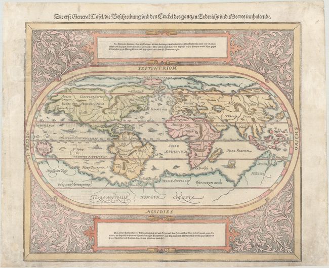
MapMaker: |
Munster/Petri
|
|
| |
| |
Subject: |
World |
|
| |
Period/Size: |
1588 / 12.0" x 14.3" (30.5 x 36.4 cm)
|
|
| |
Color: |
Colored
|
|
| |
Condition: |
(B+) There are some small abrasions along the neatline and some professional paper restoration in the blank margins, which are lightly soiled. Minor show-through of the text on verso. (condition help) |
|
| |
Source: |
Cosmographey Oder Beschreibung Aller Länder |
|
| |
References: |
Shirley #163; Shirley (BL Atlases) T.MUN-1l #1. |
|
| |
|
|
| Sales Information |
| |
| |
Price: |
|
|
| |
| |
Offered by: |
Old World Auctions |
|
| |
Catalog: |
Auction No. 183 - Antique Maps, Charts, Atlases & Globes (9529) |
|
| |
Lot/Item #: |
9 |
|
| |
| |
Date: |
06/2021
|
|
| |
| |
|