Title:
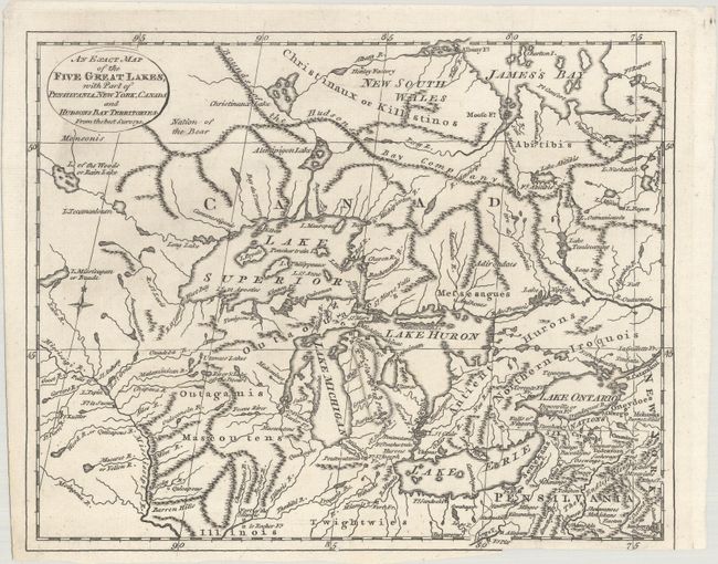
“An Exact Map of the Five Great Lakes, with Part of Pensilvania, New York, Canada and Hudsons Bay Territories. From the Best Surveys”
Map Maker:
John Lodge
This handsome Revolutionary War era map of ... (full text available to subscribers)
| Item Detail |
| |
| |
MapMaker: |
John Lodge
|
|
| |
| |
Subject: |
Colonial Great Lakes, Canada |
|
| |
Period/Size: |
1778 / 8.1" x 10.1" (20.6 x 25.7 cm)
|
|
| |
Color: |
Black & White
|
|
| |
Condition: |
(B+) A crisp impression on a clean sheet of watermarked paper. There is a binding trim at lower right with small loss of border and an associated tiny tear that has been closed on verso with archival tape. (condition help) |
|
| |
Source: |
The History of America... |
|
| |
References: |
Phillips (Maps) p. 859. |
|
| |
|
|
| Sales Information |
| |
| |
Price: |
|
|
| |
| |
Offered by: |
Old World Auctions |
|
| |
Catalog: |
Auction No. 183 - Antique Maps, Charts, Atlases & Globes (9529) |
|
| |
Lot/Item #: |
101 |
|
| |
| |
Date: |
06/2021
|
|
| |
| |
|
Antique Maps - Valuation and Pricing, Descriptions, Resources |
|
Home |
Information |
Search |
Register |
Contact Us |
Site Map
Americana Exchange, Inc. © 1999 - 2024 Americana Exchange, Inc.. All rights reserved.
OldMaps.com, the OldMaps.com logo and
AMPR are service marks or registered service marks of Americana Exchange, Inc..
|