| Item Detail |
| |
| |
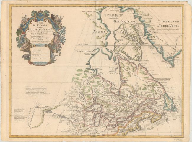
MapMaker: |
Guillaume Delisle
|
|
| |
| |
Subject: |
Colonial Northeastern United States & Canada, Great Lakes |
|
| |
Period/Size: |
1703 / 19.6" x 25.6" (49.8 x 65.1 cm)
|
|
| |
Color: |
Colored
|
|
| |
Condition: |
(B+) Contemporary outline color on watermarked paper with later color in the title cartouche. There is light printer's ink residue and remnants of masking tape on verso along the top and left sheet edges from a previous framing. (condition help) |
|
| |
Source: |
|
|
| |
References: |
Kershaw #312; cf. Schwartz & Ehrenberg p. 135-137, Plt. 80; Tooley (Amer), p. 20, #38. |
|
| |
|
|
| Sales Information |
| |
| |
Price: |
|
|
| |
| |
Offered by: |
Old World Auctions |
|
| |
Catalog: |
Auction No. 183 - Antique Maps, Charts, Atlases & Globes (9529) |
|
| |
Lot/Item #: |
96 |
|
| |
| |
Date: |
06/2021
|
|
| |
| |
|