Title:
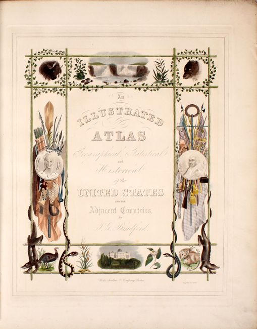
“An Illustrated Atlas Geographical Statistical and Historical of the United States and the Adjacent Countries”
Map Maker:
Thomas Gamaliel Bradford
In 1838 Bradford published this larger and much fi... (full text available to subscribers)
| Item Detail |
| |
| |
MapMaker: |
Thomas Gamaliel Bradford
|
|
| |
| |
Subject: |
Atlases |
|
| |
Period/Size: |
1838 / 19.9" x 16.4" (50.6 x 41.7 cm)
|
|
| |
Color: |
Colored
|
|
| |
Condition: |
(A) The maps are almost entirely near fine to fine with strong impressions and beautiful hand coloring. Three maps in very good condition include: the United States map with light offsetting and minor toning along the centerfold; Virginia with light scat (condition help) |
|
| |
Source: |
|
|
| |
References: |
Phillips (Atlases) #1381 & 11028; Ristow pp. 270-271; Day #32; Phillips (M) p. 842; cf. Martin & Martin #31. |
|
| |
|
|
| Sales Information |
| |
| |
Price: |
|
|
| |
| |
Offered by: |
Old World Auctions |
|
| |
Catalog: |
Auction No. 183 - Antique Maps, Charts, Atlases & Globes (9529) |
|
| |
Lot/Item #: |
556 |
|
| |
| |
Date: |
06/2021
|
|
| |
| |
|
Antique Maps - Valuation and Pricing, Descriptions, Resources |
|
Home |
Information |
Search |
Register |
Contact Us |
Site Map
Americana Exchange, Inc. © 1999 - 2024 Americana Exchange, Inc.. All rights reserved.
OldMaps.com, the OldMaps.com logo and
AMPR are service marks or registered service marks of Americana Exchange, Inc..
|