| Item Detail |
| |
| |
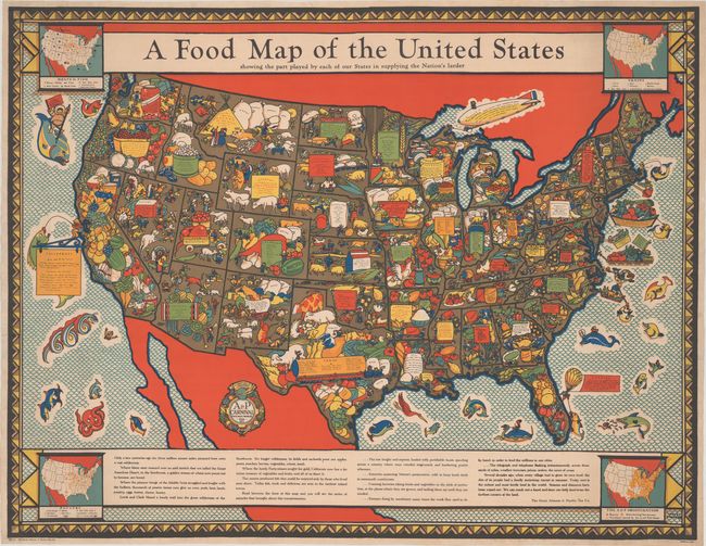
MapMaker: |
Louis Fancher
|
|
| |
| |
Subject: |
United States |
|
| |
Period/Size: |
1933 / 33.0" x 43.0" (83.9 x 109.3 cm)
|
|
| |
Color: |
Colored
|
|
| |
Condition: |
(A) A lovely, bold example that has been professionally backed in archival tissue, repairing a number of small tears along the edges of the sheet, two of which enter about 2" into the image at right and left. (condition help) |
|
| |
Source: |
|
|
| |
References: |
Rumsey #9754. |
|
| |
|
|
| Sales Information |
| |
| |
Price: |
|
|
| |
| |
Offered by: |
Old World Auctions |
|
| |
Catalog: |
Auction No. 183 - Antique Maps, Charts, Atlases & Globes (9529) |
|
| |
Lot/Item #: |
114 |
|
| |
| |
Date: |
06/2021
|
|
| |
| |
|