| Item Detail |
| |
| |
MapMaker: |
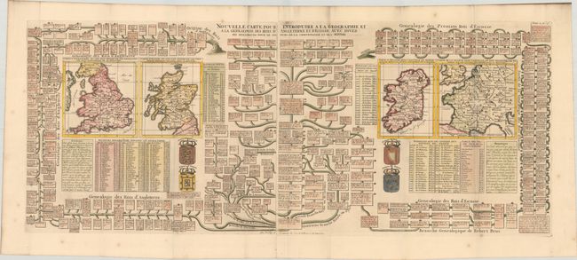
Henry Abraham Chatelain
|
|
| |
| |
Subject: |
Britain, France |
|
| |
Period/Size: |
1708 / 14.6" x 36.4" (37.1 x 92.5 cm)
|
|
| |
Color: |
Colored
|
|
| |
Condition: |
(B+) A sharp impression on bright sheets with an "ICH" watermark, issued folding with very light foxing mostly confined to the blank margins. There is dark soiling along the top and left edges of the sheets, entering the image a bit at top center. (condition help) |
|
| |
Source: |
Atlas Historique |
|
| |
References: |
|
|
| |
|
|
| Sales Information |
| |
| |
Price: |
|
|
| |
| |
Offered by: |
Old World Auctions |
|
| |
Catalog: |
Auction No. 183 - Antique Maps, Charts, Atlases & Globes (9529) |
|
| |
Lot/Item #: |
325 |
|
| |
| |
Date: |
06/2021
|
|
| |
| |
|