Title:
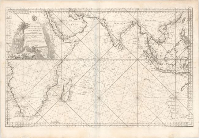
“Carte Reduite de l Ocean Oriental ou Mer des Indes Seconde Edition pour Servir aux Vaisseaux du Roy...”
Map Maker:
Jacques Nicolas Bellin
This large-scale sea chart covers southern Asia an... (full text available to subscribers)
| Item Detail |
| |
| |
MapMaker: |
Jacques Nicolas Bellin
|
|
| |
| |
Subject: |
Indian Ocean |
|
| |
Period/Size: |
1757 / 21.9" x 34.6" (55.7 x 87.9 cm)
|
|
| |
Color: |
Black & White
|
|
| |
Condition: |
(B+) On a sheet with a large coat of arms watermark and professional repairs to a chip in the title cartouche and three edge tears which enter the map image, the longest measuring 3.5". (condition help) |
|
| |
Source: |
|
|
| |
References: |
Norwich #280. |
|
| |
|
|
| Sales Information |
| |
| |
Price: |
|
|
| |
| |
Offered by: |
Old World Auctions |
|
| |
Catalog: |
Auction No. 183 - Antique Maps, Charts, Atlases & Globes (9529) |
|
| |
Lot/Item #: |
493 |
|
| |
| |
Date: |
06/2021
|
|
| |
| |
|
Antique Maps - Valuation and Pricing, Descriptions, Resources |
|
Home |
Information |
Search |
Register |
Contact Us |
Site Map
Americana Exchange, Inc. © 1999 - 2024 Americana Exchange, Inc.. All rights reserved.
OldMaps.com, the OldMaps.com logo and
AMPR are service marks or registered service marks of Americana Exchange, Inc..
|