| Item Detail |
| |
| |
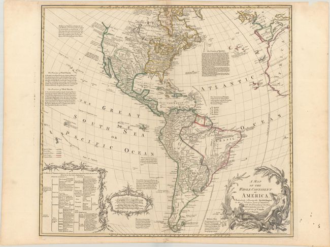
MapMaker: |
Bowles
|
|
| |
| |
Subject: |
Western Hemisphere - America |
|
| |
Period/Size: |
1763 / 19.7" x 21.6" (50.1 x 54.9 cm)
|
|
| |
Color: |
Colored
|
|
| |
Condition: |
(A) A nice impression with contemporary outline color on a bright sheet with a Strasburg Lily watermark. There is light soiling along the edges of the sheet and a chip at top right, well away from the image. (condition help) |
|
| |
Source: |
|
|
| |
References: |
McGuirk #113. |
|
| |
|
|
| Sales Information |
| |
| |
Price: |
|
|
| |
| |
Offered by: |
Old World Auctions |
|
| |
Catalog: |
Auction No. 184 - Antique Maps, Charts, Atlases & Globes (9549) |
|
| |
Lot/Item #: |
88 |
|
| |
| |
Date: |
09/2021
|
|
| |
| |
|