Title:
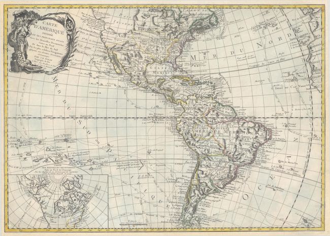
“Carte d'Amerique Divisee en ses Principaux Etats avec les Nouvelles Decouvertes Faites au Nord et dans la Mer du Sud par les Plus Celebres Navigateurs...”
Map Maker:
Jean Baptiste Nolin
The era of exploration is dramatically shown on th... (full text available to subscribers)
| Item Detail |
| |
| |
MapMaker: |
Jean Baptiste Nolin
|
|
| |
| |
Subject: |
Western Hemisphere - America |
|
| |
Period/Size: |
1787 / 20.4" x 28.7" (51.9 x 72.9 cm)
|
|
| |
Color: |
Colored
|
|
| |
Condition: |
(B+) A nice impression on a sturdy sheet that has been professionally remargined on all sides with the neatline replaced in facsimile. A chip at bottom left has also been professionally repaired with a portion of the border replaced in facsimile. There (condition help) |
|
| |
Source: |
|
|
| |
References: |
|
|
| |
|
|
| Sales Information |
| |
| |
Price: |
|
|
| |
| |
Offered by: |
Old World Auctions |
|
| |
Catalog: |
Auction No. 184 - Antique Maps, Charts, Atlases & Globes (9549) |
|
| |
Lot/Item #: |
93 |
|
| |
| |
Date: |
09/2021
|
|
| |
| |
|
Antique Maps - Valuation and Pricing, Descriptions, Resources |
|
Home |
Information |
Search |
Register |
Contact Us |
Site Map
Americana Exchange, Inc. © 1999 - 2024 Americana Exchange, Inc.. All rights reserved.
OldMaps.com, the OldMaps.com logo and
AMPR are service marks or registered service marks of Americana Exchange, Inc..
|